This project aims to produce original work that will add to what we already know about the archaeology of Chilmington Green and the surrounding area. This will be co-produced by volunteers and professional members of the team, and will be showcased on this website, as well as through lectures, workshops, museum displays and academic publications. You don’t need any prior experience- just enthusiasm to find out more about Chilmington’s extraordinary past!
Geology and Topography
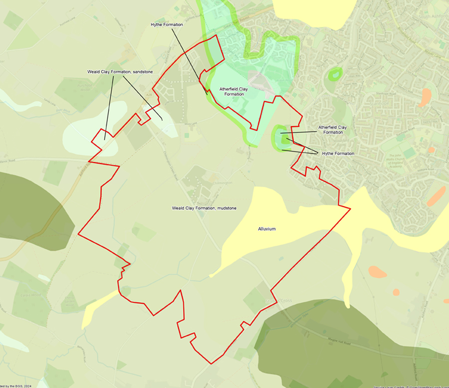
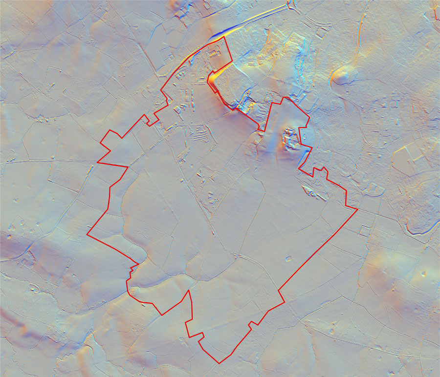
Geology and topography are important to archaeologists, as they usually play a significant role in the ways in which a landscape was used by people in the past. Chilmington Green is fairly flat at a height of about 37 to 40m above sea level. Modern Chilmington is now situated on well drained farmland, but in the ancient past, it was quite different, being wet and prone to flooding from tributaries of the Great Stour and the East Stour. There are, however, some areas of higher, drier ground towards the northwest (around 43m above sea level), and this is where most settlement occurred in the ancient past. The highest point of all is Coleman’s Kitchen Wood, located at around 60m above sea level. You can see these higher areas on this LiDAR image of the site- move the slider across to reveal them. Read about LiDAR, and how it works here.
Chilmington Green is located within the Weald, close to the foot of the North Downs, in an area typified by a clay geology with pockets of limestone that formed during the Cretaceous period. In places, river mud (alluvium) accumulated over this, which would have helped to create a fertile area suitable for growing crops and farming animals. To the north of Chilmington, at the foot of the Downs, the landscape rises and the geology changes to sandstone and limestone known as the Hythe Formation (also of Cretaceous date). At Coleman’s Kitchen Wood, these deposits were quarried from at least the post-medieval period and probably before, primarily for use in construction.